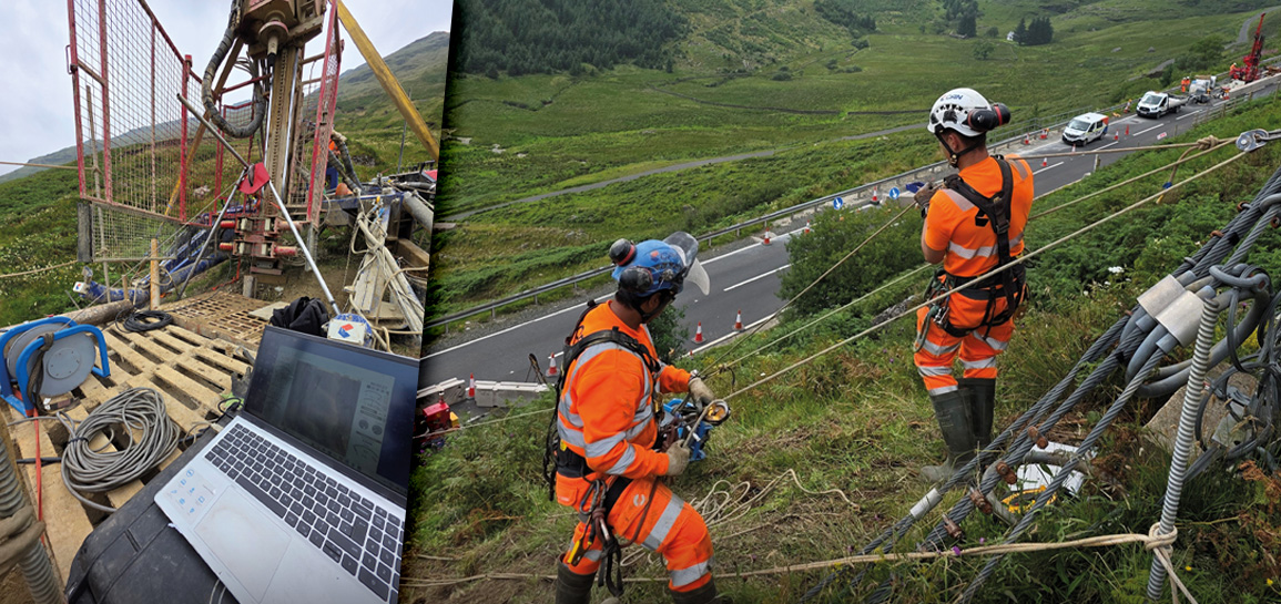
Robertson Geo Services (RGS) was contracted to provide borehole logging services to support the geotechnical investigations. Numerous visits to multiple locations were conducted to gather vital data about the subsurface structure. This work included identification of the main fracture orientations, collecting sonic velocity profiles and hydrogeological investigation.
Working on the steep slopes of the A83 presented a unique set of challenges. The equipment needed to be moved to multiple locations, both up and down slopes, accessing the boreholes necessary to create a comprehensive picture of the subsurface formations.
A fully mobile setup, based around the Mini Winch and Micrologger2 was deployed, allowing access to difficult to reach boreholes. The lightweight winch is an integral part of any portable logging setup, permitting logging where vehicles cannot access.
On-site safety was a primary concern where safety harnesses and safety ropes were used, under the control of a professional rope access crew. Full training for working at heights and in the use of the equipment had been previously undertaken by the RGS engineers.
The project required a suite of five probes to gather the data required for a comprehensive understanding of the rock mass:
• High Resolution Optical Televiewer (Hi-OPTV)®
• High Resolution Acoustic Televiewer (HRAT)®
• Temperature Conductivity Probe
• PS Logger® Probe
• Borehole Geometry Probe
Geophysical borehole logging supplies key in-situ data for slope stability analysis which complements other geotechnical investigative techniques such as spatial mapping, surface seismic and CPT. Borehole logging works equally well in all types of formation, from unconsolidated sediments through to the hardest rocks, producing digital data that can easily be combined into structural databases.
The very nature of slopes means that logging crews need to be flexible to successfully log angled or even horizontal boreholes, which may be difficult to access requiring the use of portable systems.


