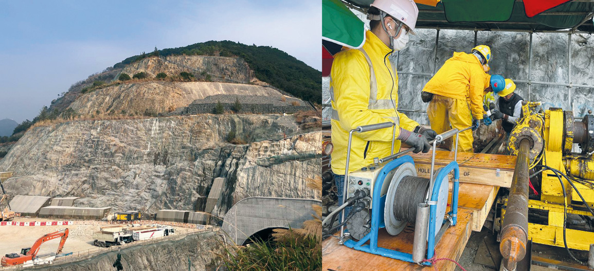
A Civil Engineering and Development Department (CEDD) works that includes forming about 40 hectares of land platforms at the Anderson Road Quarry (ARQ) Site. The associated geotechnical works; road works including construction of approximately three kilometre long vehicular roads, footpaths, cycle tracks, and approximately 1.30m long underpass at the southern end and a public transport terminus at the northern end of the ARQ site; provision of and improvement to water supply, drainage, and sewerage systems as well as landscaping works.
The High Resolution Optical Televiewer (Hi-OPTV) has been used to check the formation/fracture regime inside the Anderson Road’s landslide. A 100m long horizontal borehole was drilled into the hillside, and GCE fabricated a pushrod system with custom centralisers to push the Hi-OPTV to the end of the borehole. They then used the Robertson Geo Mini Winch to pull the Hi-OPTV out of the borehole whilst acquiring the log data. The set-up proved challenging.
After testing, it was decided to mount the depth wheel on the roof canopy above the borehole, as it helped maintain a more constant speed and improved the log quality.
During the tests, water was observed coming out from the borehole, which caused the image to be a little compromised due to the unwanted water settling at the bottom of the borehole.
It’s not unusual for water to be present (even in the dry season) as a confined aquifer is likely to be inside a landslide. There was little rain during the test and the day before the test, therefore, the image got more “water distortion” than expected.
It is recommended doing such a test during the dry season (if possible) as all the water coming from the confined aquifer cannot dry out.


